 Catalogue PIGMA
/Données dérivées/Données de type modèle
Type of resources
Available actions
Topics
Keywords
Contact for the resource
Provided by
Years
Formats
Representation types
Update frequencies
status
Scale
Resolution
-

NEMO est une plateforme de modélisation numérique de l’océan. Les applications développées grâce à cet outil permettent de faire progresser les connaissances sur l’océan et le climat, et de faire des prévisions et des projections sur le futur. NEMO modélise l’océan et ses interactions avec les autres composantes du système climatique terrestre : - La dynamique et la thermodynamique océanique - La glace de mer - Les traceurs océaniques et de la biogéochimie marine NEMO repose sur les ressources informatiques du GENCI – le grand équipement national de calcul intensif- et sur différents centres de calcul à l’échelle européenne et mondiale. Les produits issus des observations en mer ou satellite sont utilisés dans les états initiaux des modèles et pour les valider, mais les modèles sont utilisés en mode prédictif, comme un « océan virtuel », à différentes échelles de temps et d’espace. Le consortium NEMO comprend actuellement 5 partenaires : le Centro Euro-Mediterraneo sui Cambiamenti Climatici (CMCC), le Centre National de la Recherche Scientifique (CNRS), Mercator Océan International (MOI), le UK Met Office (UKMO) et le National Oceanographic Centre (NOC).
-
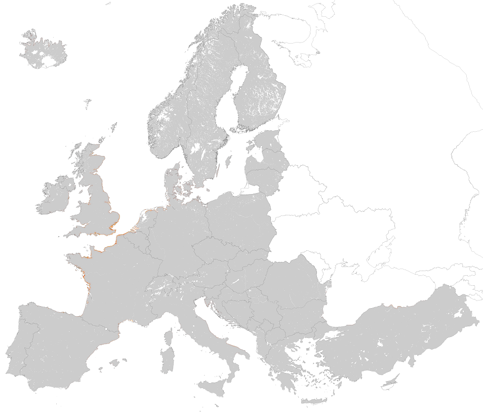
This metadata corresponds to the EUNIS Littoral biogenic habitat (salt marshes) types, predicted distribution of habitat suitability dataset. Littoral habitats are those formed by animals such as worms and mussels or plants (salt marshes). The verified littoral biogenic habitat samples used are derived from the Braun-Blanquet database (http://www.sci.muni.cz/botany/vegsci/braun_blanquet.php?lang=en) which is a centralised database of vegetation plots and comprises copies of national and regional databases using a unified taxonomic reference database. The geographic extent of the distribution data are all European countries except Armenia and Azerbaijan. The modelled suitability for EUNIS saltmarsh habitat types is an indication of where conditions are favourable for the habitat type based on sample plot data (Braun-Blanquet database) and the Maxent software package. The modelled suitability map may be used as a proxy for the geographical distribution of the habitat type. However, note that it is not representing the actual distribution of the habitat type. As predictors for the suitabilty modelling not only Climate and Soil parameters have been taken into account, but also so-called RS-EVB's, Remote Sensing-enabled Essential Biodiversity Variables like Landuse, Vegetation height, Phenology, LAI(Leave Area Index) and Population density. Because the EBV's are restricted by the extent of the Remote Sensing data (EEA38 countries and the United Kingdom) the modelling result does also not go beyond this boundary. The dataset is provided both in Geodatabase and Geopackage formats. The Training map files show the modelled suitable distribution, omitting the 10% of occurrence records in the least suitable environment under the assumption that they are not representative of the overall suitable habitat distribution. The 10 percentile training presence is an arbitrary threshold which omits all regions with habitat suitability lower than the suitability values for the lowest 10% of occurrence records.
-
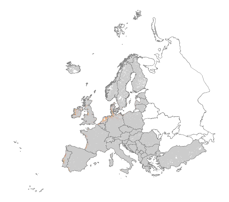
This metadata corresponds to the EUNIS Coastal habitat types, predicted distribution of habitat suitability dataset. Coastal habitats are those above spring high tide limit (or above mean water level in non-tidal waters) occupying coastal features and characterised by their proximity to the sea, including coastal dunes and wooded coastal dunes, beaches and cliffs. Includes free-draining supralittoral habitats adjacent to marine habitats which are normally only very rarely subject to any type of salt water, in as much as they may be inhabited predominantly by terrestrial species, strandlines characterised by terrestrial invertebrates and moist and wet coastal dune slacks and dune-slack pools. Supralittoral sands and wracks may be found also in marine habitats (M). Excludes supralittoral rock pools and habitats, the splash zone immediately above the the mean water line, as well the spray zone and zone subject to sporadic inundation with salt water in as much as it may be inhabited predominantly by marine species, which are included in marine (M). The modelled suitability for EUNIS coastal habitat types is an indication of where conditions are favourable for the habitat type based on sample plot data (Braun-Blanquet database) and the Maxent software package. The modelled suitability map may be used as a proxy for the geographical distribution of the habitat type. Note however that it is not representing the actual distribution of the habitat type. As predictors for the suitability modelling not only climate and soil parameters have been taken into account, but also so-called RS-EVB's, Remote Sensing-enabled Essential Biodiversity Variables, like land use, vegetation height, phenology, and LAI (Leaf Area Index). Because the EBV's are restricted by the extent of the remote sensing data (EEA38 countries and the United Kingdom) the modelling result does also not go beyond this boundary. The dataset is provided both in Geodatabase and Geopackage formats.
-
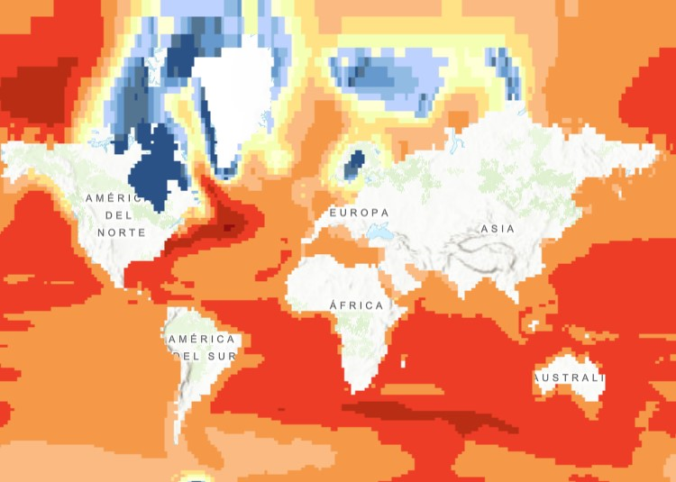
The raster dataset (1ºx1º) shows the projected change in relative sea level (in metres) in 2081-2100 compared to 1986-2005 for the medium-low emission scenario RCP4.5, based on an ensemble of Coupled Model Intercomparison Project Phase 5 (CMIP5) climate models. Projections consider land movement due to glacial isostatic adjustment but not land subsidence due to human activities. No projections are available for the Black Sea. The dataset has been used as a source for an earlier version of the EEA indicator “Global and European Sea Level”: https://www.eea.europa.eu/data-and-maps/indicators/sea-level-rise-5/assessment.
-

Cette archive contient les résultats du modèle hydrodynamique MFS - EAS6 du CMCC servant de forçage aux modèles côtiers en Méditerranée.
-
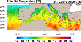
Ce jeu de données contient les résultats journaliers (archives et prévisions) du modèle hydrodynamique MFS configuration "EAS 5" du Centro Euro-Mediterraneo sui Cambiamenti Climatici (CMCC). Les résultats sont collectés quotidiennement via le portail Copernicus Marine (produit MEDSEA_ANALYSIS_FORECAST_PHY_006_013 - daily). Ces données sont utilisées comme données de forçage pour les modèles côtiers en Méditerranée. Variables : température, courants, salinité sur 72 profondeurs, journaliers
-
Auxiliary products - Tide elevations, Tide currents, Tide loading
-

The "EMODnet Digital Bathymetry (DTM) - 2016" is a multilayer bathymetric product for Europe’s sea basins covering:: • the Greater North Sea, including the Kattegat and stretches of water such as Fair Isle, Cromarty, Forth, Forties, Dover, Wight, and Portland • the English Channel and Celtic Seas • Western and Central Mediterranean Sea and Ionian Sea • Bay of Biscay, Iberian coast and North-East Atlantic • Adriatic Sea • Aegean - Levantine Sea (Eastern Mediterranean) • Azores - Madeira EEZ • Canary Islands • Baltic Sea • Black Sea • Norwegian – Icelandic seas The DTM is based upon more than 7700 bathymetric survey data sets and Composite DTMs that have been gathered from 27 data providers from 18 European countries and involving 169 data originators. The gathered survey data sets can be discovered and requested for access through the Common Data Index (CDI) data discovery and access service that also contains additional European survey data sets for global waters. This discovery service makes use of SeaDataNet standards and services and have been integrated in the EMODnet portal (https://emodnet.ec.europa.eu/en/bathymetry#bathymetry-services ). The Composite DTMs are described using the Sextant Catalogue Service that makes also use of SeaDataNet standards and services. Their metadata can retrieved through interrogating the Source Reference map in the Central Map Viewing service (https://emodnet.ec.europa.eu/geoviewer/ ). In addition, the EMODnet Map Viewer gives users wide functionality for viewing and downloading the EMODnet digital bathymetry such as: • water depth (refering to the Lowest Astronomical Tide Datum - LAT) in gridded form on a DTM grid of 1/8 * 1/8 arc minute of longitude and latitude (ca 230 * 230 meters) • option to view depth parameters of individual DTM cells and references to source data • option to download DTM in 16 tiles in different formats: EMO, EMO (without GEBCO data), ESRI ASCII, ESRI ASCII Mean Sea Level, XYZ, NetCDF (CF), RGB GeoTiff and SD • layer with a number of high resolution DTMs for coastal regions • layer with wrecks from the UKHO Wrecks database. The NetCDF (CF) DTM files are fit for use in a special 3D Viewer software package which is based on the existing open source NASA World Wind JSK application. It has been developed in the frame of the EU FP7 Geo-Seas project (another sibling of SeaDataNet for marine geological and geophysical data) and is freely available. The 3D viewer also supports the ingestion of WMS overlay maps. The SD files can also be used for 3D viewing by means of the freely available iView4De(Fledermaus) software. The original datasets themselves are not distributed but described in the metadata services, giving clear information about the background survey data used for the DTM, their access restrictions, originators and distributors and facilitating requests by users to originator.
-
The "EMODnet Digital Bathymetry (DTM) - 2016" is a multilayer bathymetric product for Europe’s sea basins covering:: • the Greater North Sea, including the Kattegat and stretches of water such as Fair Isle, Cromarty, Forth, Forties, Dover, Wight, and Portland • the English Channel and Celtic Seas • Western and Central Mediterranean Sea and Ionian Sea • Bay of Biscay, Iberian coast and North-East Atlantic • Adriatic Sea • Aegean - Levantine Sea (Eastern Mediterranean) • Azores - Madeira EEZ • Canary Islands • Baltic Sea • Black Sea • Norwegian – Icelandic seas The DTM is based upon more than 7700 bathymetric survey data sets and Composite DTMs that have been gathered from 27 data providers from 18 European countries and involving 169 data originators. The gathered survey data sets can be discovered and requested for access through the Common Data Index (CDI) data discovery and access service that also contains additional European survey data sets for global waters. The Composite DTMs can be discovered through the Sextant Catalogue service. Both discovery services make use of SeaDataNet standards and services and have been integrated in the EMODnet portal (https://emodnet.ec.europa.eu/en/bathymetry#bathymetry-services ). In addition, the EMODnet Map Viewer (https://emodnet.ec.europa.eu/geoviewer/ ) gives users wide functionality for viewing and downloading the EMODnet digital bathymetry such as: • water depth (refering to the Lowest Astronomical Tide Datum - LAT) in gridded form on a DTM grid of 1/8 * 1/8 arc minute of longitude and latitude (ca 230 * 230 meters) • option to view depth parameters of individual DTM cells and references to source data • option to download DTM in 16 tiles in different formats: EMO, EMO (without GEBCO data), ESRI ASCII, ESRI ASCII Mean Sea Level, XYZ, NetCDF (CF), RGB GeoTiff and SD • layer with a number of high resolution DTMs for coastal regions • layer with wrecks from the UKHO Wrecks database. The NetCDF (CF) DTM files are fit for use in a special 3D Viewer software package which is based on the existing open source NASA World Wind JSK application. It has been developed in the frame of the EU FP7 Geo-Seas project (another sibling of SeaDataNet for marine geological and geophysical data) and is freely available. The 3D viewer also supports the ingestion of WMS overlay maps. The SD files can also be used for 3D viewing by means of the freely available iView4De(Fledermaus) software. The original datasets themselves are not distributed but described in the metadata services, giving clear information about the background survey data used for the DTM, their access restrictions, originators and distributors and facilitating requests by users to originator.
-
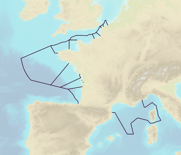
This product includes the boundaries of tidal zones for French Channel, Atlantic and Mediterranean coasts in shapefile format. Information on the characteristics of tidal zones is available as part of the "Maritime Altimetric Reference Values" product.